Mazowiecki portal informacyjny
Niezwykłe miejsca. Niesamowite historie. Niezapomniane przeżycia. Zapomnij o stereotypach. Tutaj poznasz prawdziwe Mazowsze.
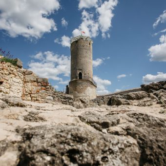
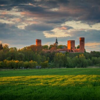
Zamek biskupów krakowskich w Iłży
Widać go z daleka, jeszcze przed wjazdem do miasta. Dumnie …
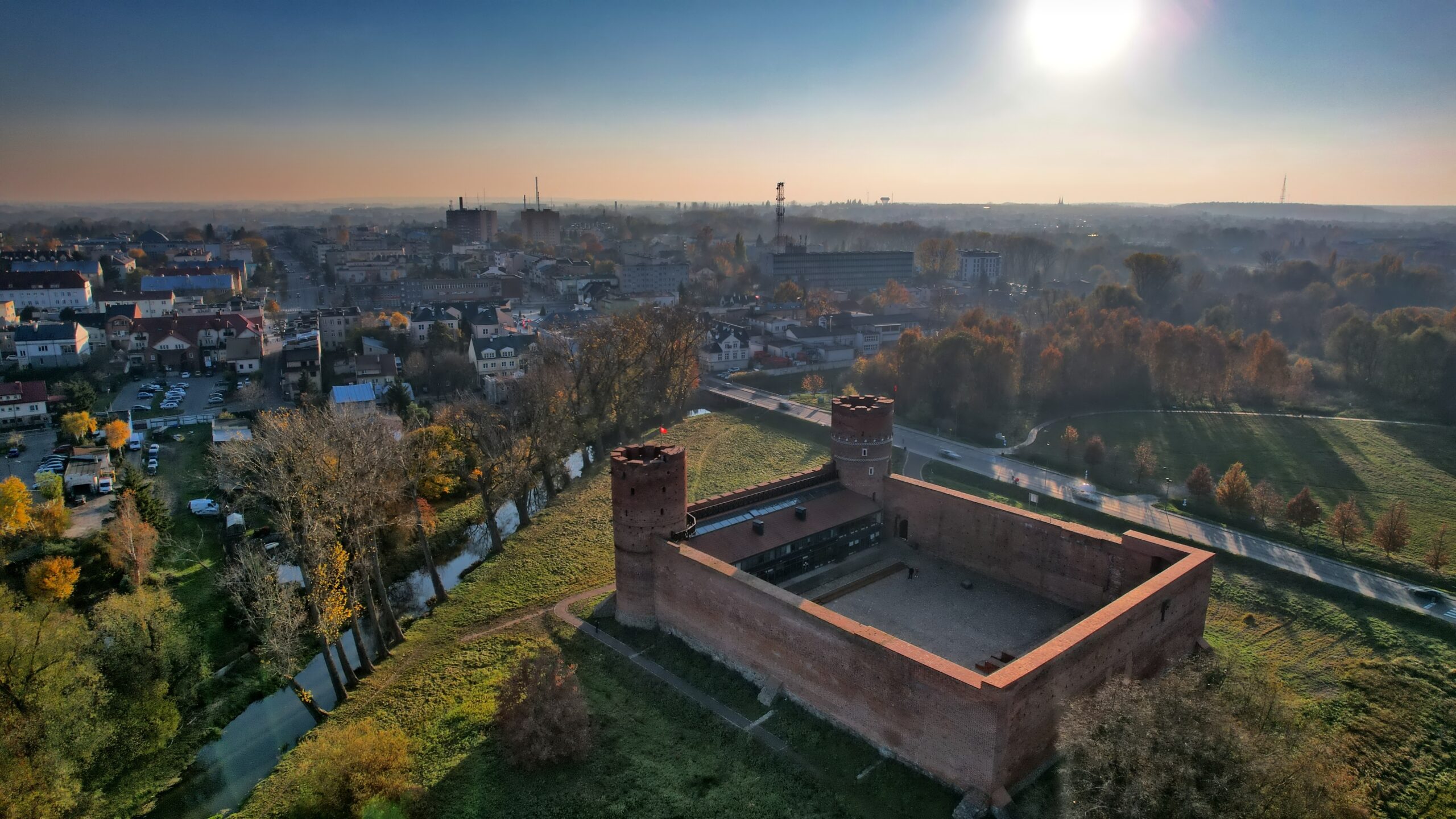
Ciechanów. City Break
Monumentalna średniowieczna twierdza – liczący ponad 6 stuleci Zamek Książąt …
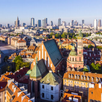
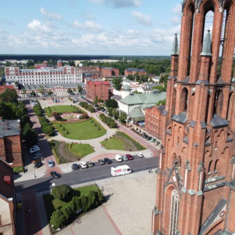
Warszawa: City Break
Aby poznać Warszawę od podszewki musiałbyś spędzić w niej kilka …
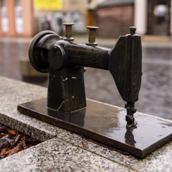
Szlak symboli radomskiego przemysłu
Nie ma chyba w Polsce dorosłego człowieka – szczególnie w …
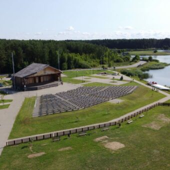
Kurpiowska Kraina. Pole kamperowe
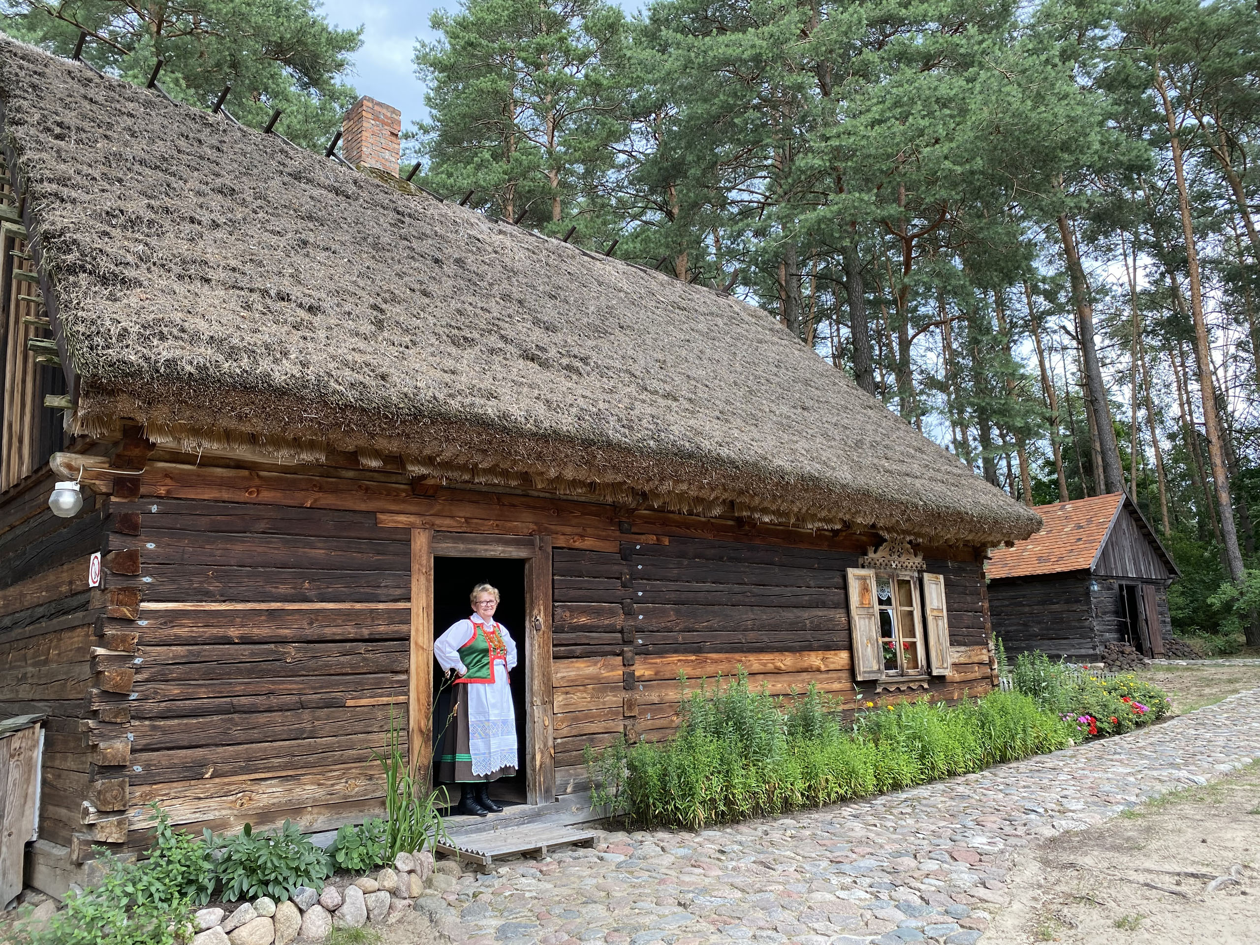
Kurpiowszczyzna to wciąż nieodkryty region na granicy Mazowsza i Mazur, …
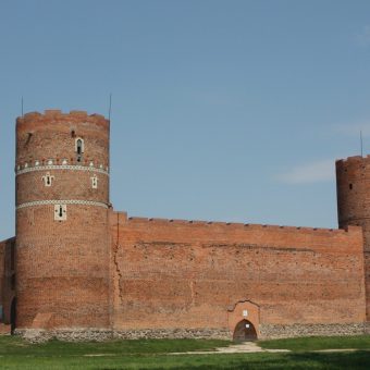
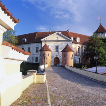
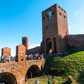
Zamek Książąt Mazowieckich w Czersku
Czersk to dzisiaj niewielka miejscowość, ale za czasów książąt mazowieckich …
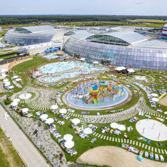
Suntago – największy wodny park rozrywki w Europie
Nie trzeba wyjeżdżać poza Mazowsze, aby poczuć klimat tropikalnych wysp. …
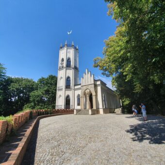
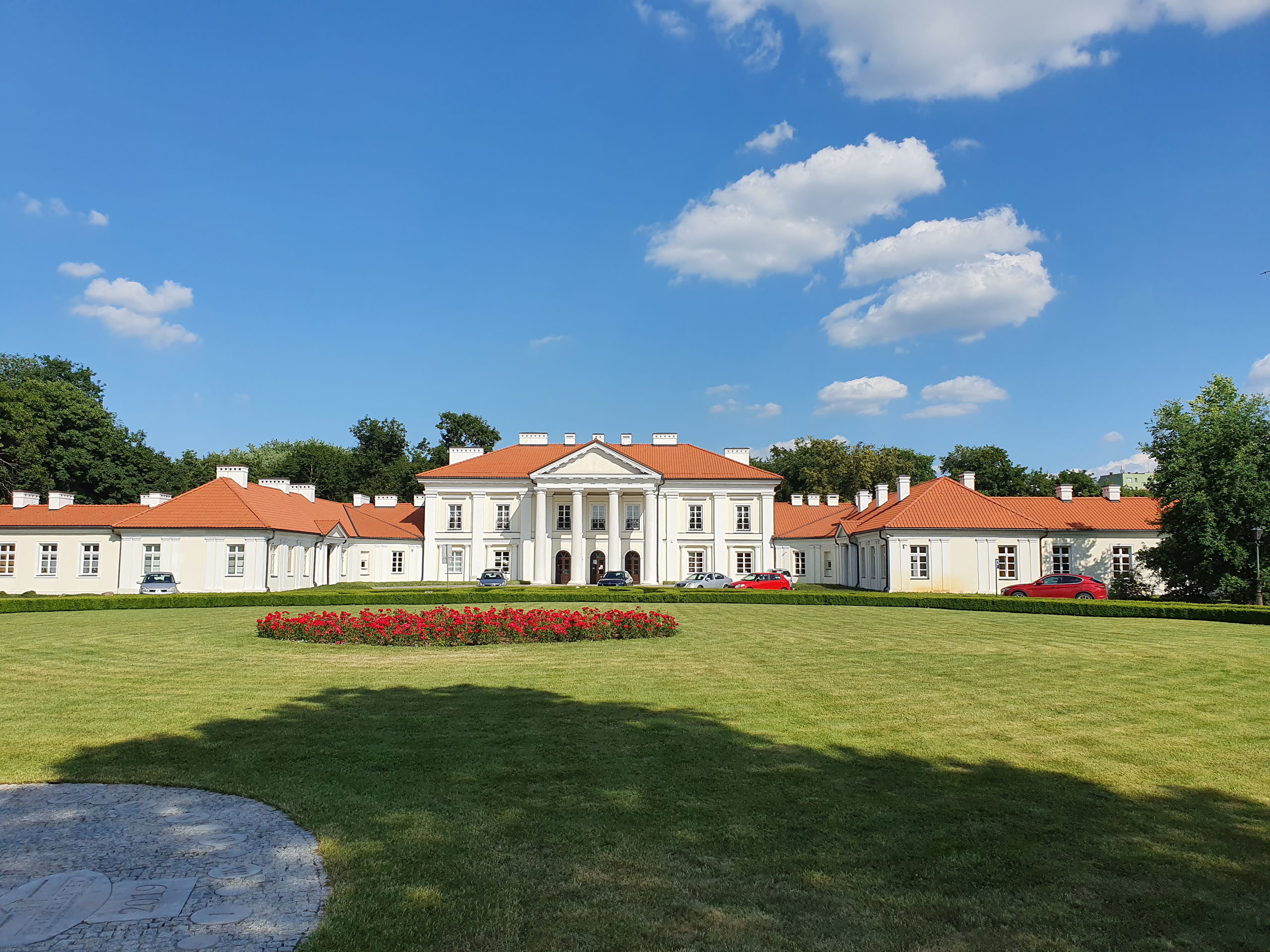
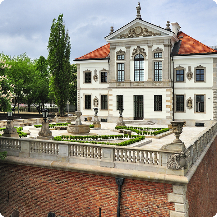
Muzeum Romantyzmu w Opinogórze
Romantyczne miejsca na Mazowszu? Neogotycki pałacyk Krasińskich z połowy XIX …
Spacer po Żyrardowie: klimat postindustrialny, historia lniarstwa
Zwiedzanie starego Żyrardowa to szansa na zobaczenie dobrze zachowanej architektury …
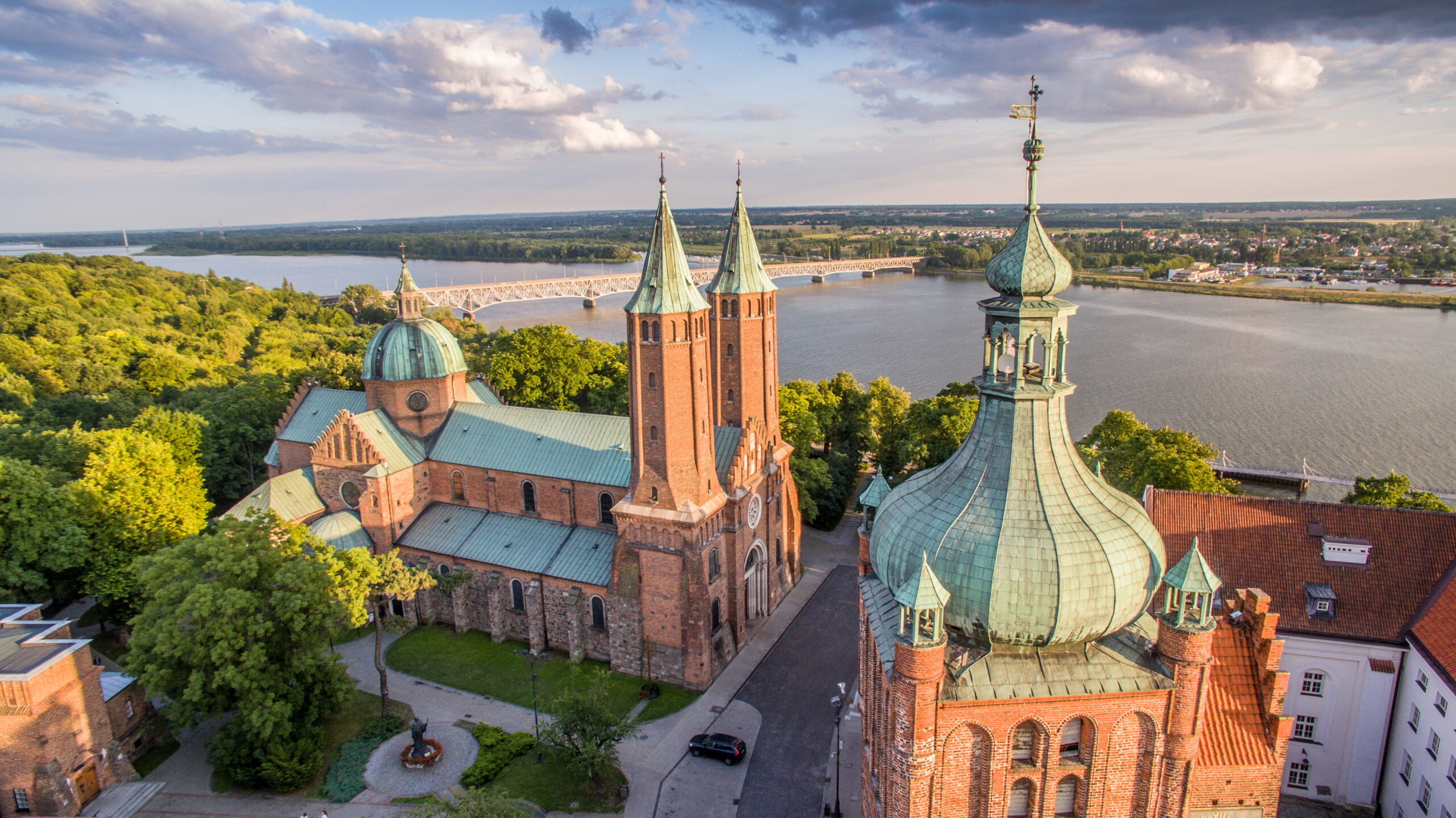
Pułtusk. Napoleon i deszcz meteorytów
Średniowieczną potęgę i znaczenie administracyjne Pułtusk zawdzięcza swojemu położeniu na …
Od czego zacząć?
Zacznij od pytania: czego chcę dziś doświadczyć? Wolisz miasto czy małą osadę? Głośną zabawę czy szum wiatru i wody? Siódme poty czy błogie lenistwo? Jeśli już wiesz, możesz wybierać.
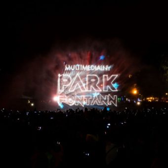
Majówka z ABBĄ w warszawskim Parku Fontann
Po ubiegłorocznym sezonie z bohaterami filmów Disneya, fontanny zatańczą w …
Julinek Park startuje z nowym sezonem!
Otwarcie bram do jednego z największych w Polsce rodzinnych parków …
Wielka Majówka – wybór wydarzeń w województwie
To nie będzie wielka majówka, a nawet nie Wielka Majówka, …

Warsaw Caravaning Festival
Trzecia edycja imprezy przyciągającej pasjonatów podróżowania, niezależności i wyjątkowych emocji …
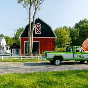
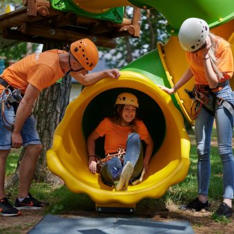
Kosmiczne Ranczo startuje z drugim sezonem!
Gdzie najłatwiej spotkać kosmitę? Na Mazowszu, a dokładnie – w …
Turniej Rycerski na zamku w Iłży
Nowy sezon na zamku w Iłży otworzy dwudniowy Turniej Rycerski. …
Miejski autobus z Warszawy do Kampinosu
Autobusy sezonowej linii 800 z Warszawy do Kampinoskiego Parku Narodowego …
Majówka i Turniej Rycerski na zamku w Czersku!
Średniowiecze na wesoło – pod takim hasłem rozpocznie się 1 …

Początek sezonu Pociągu Retro
Pociąg RETRO po raz pierwszy w nowym sezonie wyruszy w …
Wyszukaj wydarzenia
Regiony
Ceglaste zamki Mazowsza i jasne wieże ziemi radomskiej, Kurpie Zielone i Białe, złociste piachy nadbużańskich plaż... Województwo mazowieckie to kalejdoskop barw, tradycji i smaków.